Space science from elementary through high school
A space program for your school
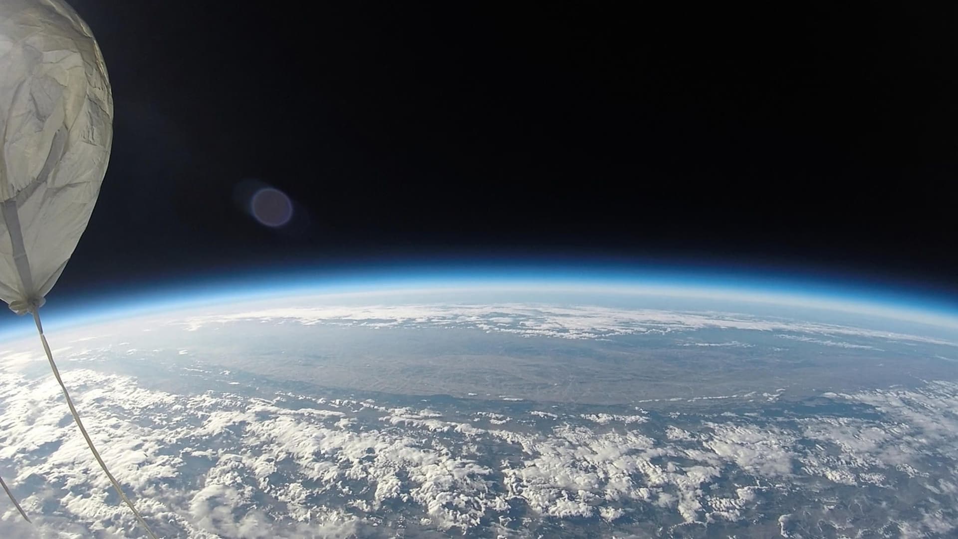
Inspire the next generation by bringing a real space mission to your school. Students build their own satellite, follow the launch to 35 km into space, and analyze real data — turning hands-on learning into real discoveries.
Briefing
Real hardware and software that collects space data.
DRPL brings the experience of a real space mission into the classroom. Students themselves 3D-print the structure, integrate the sensors, and lead the operation on launch day.
After the CubeSat is recovered, the mission continues in the debrief. The class analyzes the data logs, examines the footage, identifies what failed, and documents improvements for the next project.
- Max altitude
- 35,000 m
- Ascent speed
- 5.2 m/s
- Time to burst
- ~112 min
- Onboard cameras
- 4K
The payload
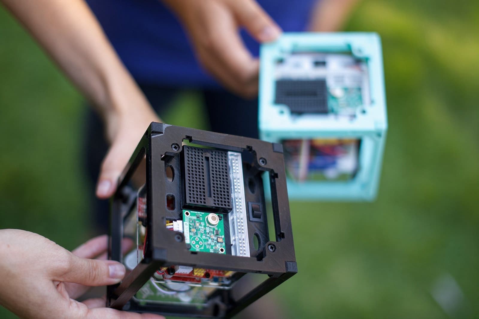
3D-printed CubeSat frame.
The payload is a 1U CubeSat. Students 3D-print the structure, build the satellite in class, and program the onboard computer with a suite of sensors. Equipped with two 4K cameras and a science bay, it is carried into space by a 1,200 g natural-latex balloon.
Flight sensors
What the payload collects
During the flight, the CubeSat records data through the sensors the students built themselves: temperature, pressure, magnetic field, motion, GPS, and light, plus two 4K cameras.
Temperature
Measures internal thermal changes through ascent, expansion at peak, and cooling on the way down.
IR temperature (Infrared)
Non-contact reading of Earth and atmosphere temperature through an optical window on the payload.
Barometric pressure
Records the drop in atmospheric pressure to calculate flight altitude in real time.
3-axis magnetometer
Maps changes in Earth’s magnetic field as the payload climbs and moves.
IMU (Inertial Measurement Unit)
A 6-axis sensor that records rotation, vibration, and G-forces at balloon burst, during descent, and at landing impact.
GPS
Provides altitude, speed, and precise coordinates in real time for tracking and payload recovery.
Visible light
Measures solar brightness and light scattering as the payload gains altitude.
Two 4K cameras
Record in high definition Earth’s curvature, balloon expansion and burst, and the CubeSat’s descent.
Balloon
Latex, helium, 35,000 meters.
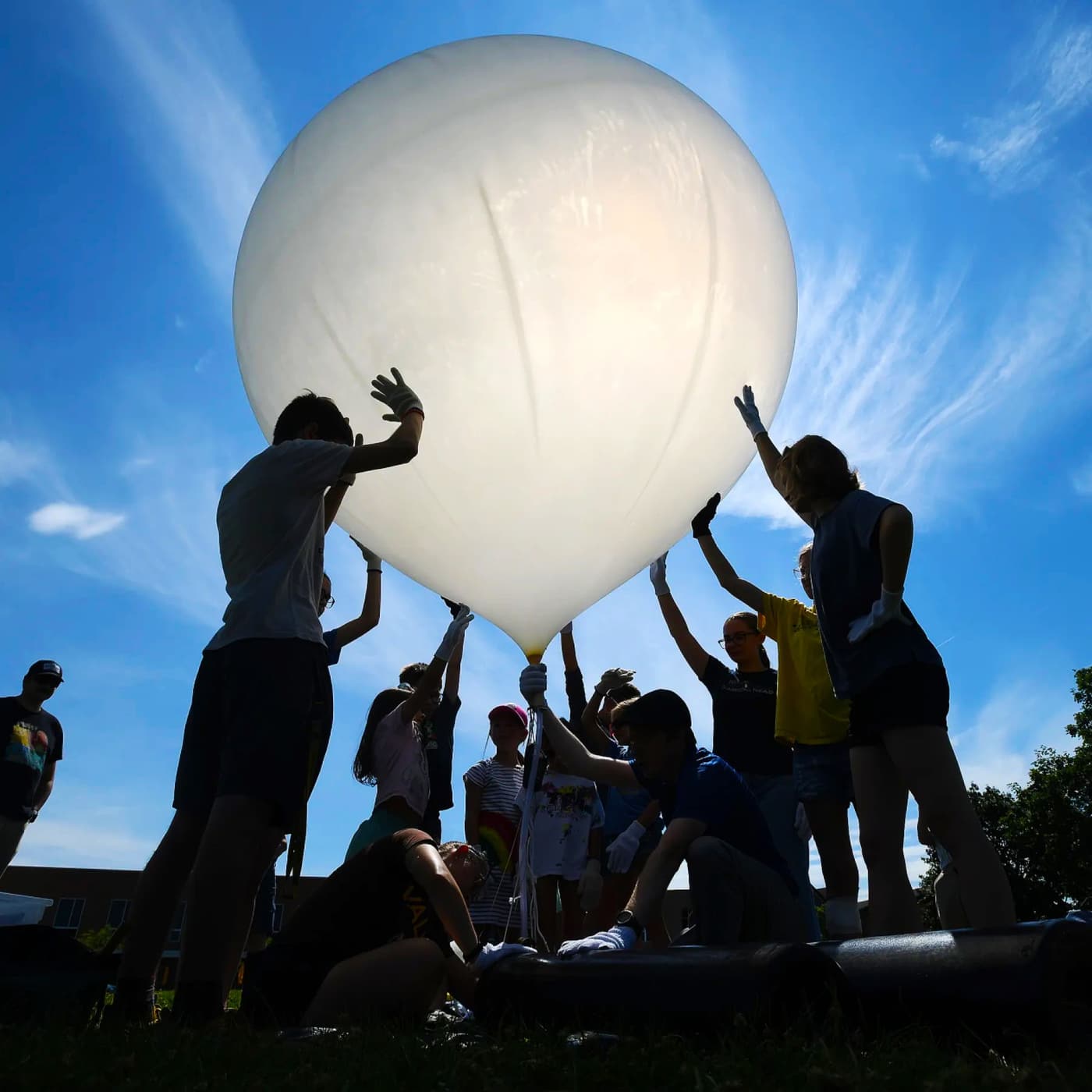
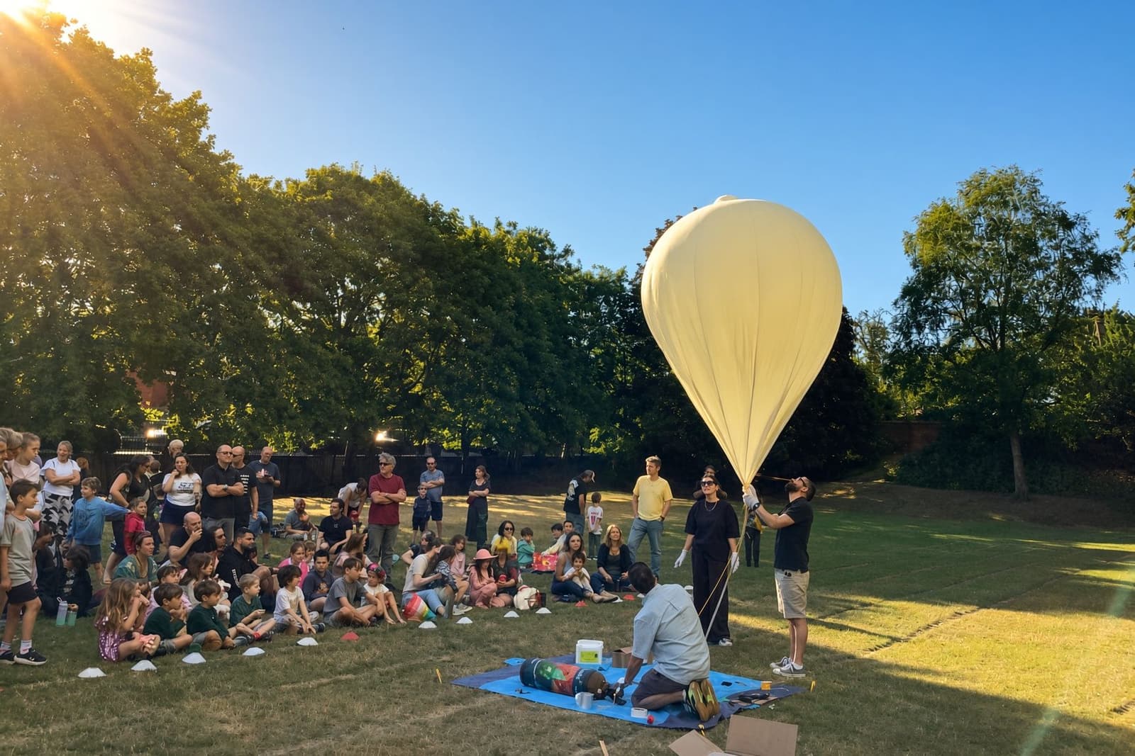
A professional meteorological balloon, inflated with helium on the school field. Ascent holds near 5.2 m/s. Around two hours later the burst happens near 35 km, the parachute opens, and GPS brings the CubeSat back.
- Altitude
- ~35,000 m
- Ascent rate
- 5.0–5.5 m/s
- Time to burst
- 105–120 min
- Balloon
- 1,200 g natural latex
- Lift gas
- Helium
- Descent
- Parachute after burst
- Recovery
- GPS + LoRa
- Payload
- 1U CubeSat + cameras
The balloon is natural latex, the same material used on sounding flights, and it biodegrades after burst. Launch days are coordinated under Brazilian high-altitude balloon rules with ANAC and DECEA.
Flight profile
Nominal
Ascent 5.0–5.5 m/s for 105–120 minutes. Burst near 35,000 m. Parachute descent and GPS recovery.
4K cameras
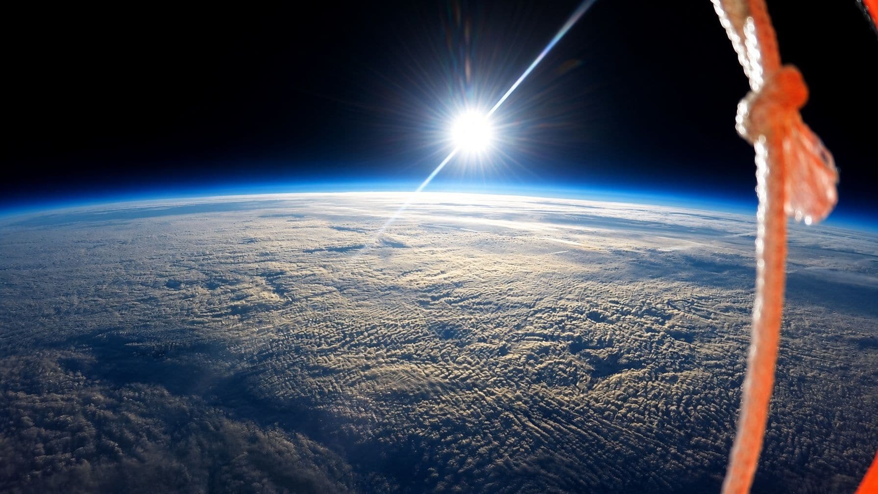
Footage from the edge of the atmosphere.
Two 4K cameras ride with the CubeSat: one looking out at the curvature, one on the balloon and payload. Burst, the black sky, and the ride down.
Approach
Design. Integrate. Launch. Recover.
- 01
Mission briefing
DRPL provides the full launch plan, component kits, and a structured schedule designed to fit the school semester.
- 02
Design & print
Students develop the 3D model in CAD, print the CubeSat structure, and make the project’s technical decisions.
- 03
Integrate & test
On the bench, the class assembles the electronics, connects sensors and cameras, tests the power systems, and validates communications before launch.
- 04
Launch day
The payload is carried to 35 km by a weather balloon, with the students themselves leading the operation's final checklist.
- 05
Recover & extract
GPS guides the team to the payload. The memory cards with the flight data return to the classroom.
- 06
Analyze & publish
Students process the altitude plots, analyze the sensor readings, and produce an official mission report for the school.
Technologies we use


Hardware and software used to prototype real satellites
For schools
A real space mission for students who are just getting started.
DRPL provides the structure, the hardware, and full operational support. Your students take on the role of engineers, and the school keeps a unique archive of data, images, and reports from an experience they will never forget.
Gradual, adaptable learning
From elementary through high school, the project scales the engineering and science challenges to the students’ exact level.
Built into the curriculum
With a lesson sequence, materials included, and a predictable schedule, the school gets a complete educational program across the semester — not a one-day event.
DRPL operational support
We handle the balloon, the helium, launch authorizations, and field recovery. The school runs the project without needing complex licenses or specialists on staff.
A lasting educational record
All telemetry, photos, videos, and reports stay with the school, as a historical and comparative baseline for classes in the years that follow.
Contact
Ready to put space science in your school’s curriculum?
Tell us your school. We’ll get in touch to schedule a conversation, walk through the project in detail, and answer every question.
Message sent
Thank you for getting in touch.
We’re excited about what we can do together to reach space. We’ll be in touch soon.